
 MaxDepth Aquatics, Inc.
|
|
Sprague River, Oregon
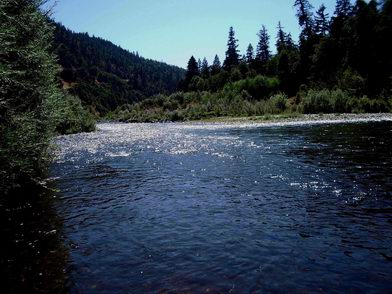
The Sprague River is located in southern Oregon and flows east to west before discharging into the Williamson River shortly before it flows into Upper Klamath Lake. The roughly 100 mile-long river has headwaters in the forested lands of the Winema National Forest before reaching the valley floor. The watershed is used extensively for agriculture (livestock and forage crops) and substantial groundwater and surface withdrawals reduce flows in the summer. MaxDepth Aquatics has been retained to conduct selected studies of the river including work on shallow-water bathymetry, water quality monitoring, and aquatic plant growth. The recent joint study with Watershed Sciences, Inc. successfully merged the morphometric data collected on selected reaches of the river with LiDAR results of the Sprague River watershed. 3D Image of merged LiDAR and bathymetric data from the Sprague River. (click image for full-res version ~500kb)
|
|
Copyright © 2003
MaxDepth Aquatics, Inc.
|